
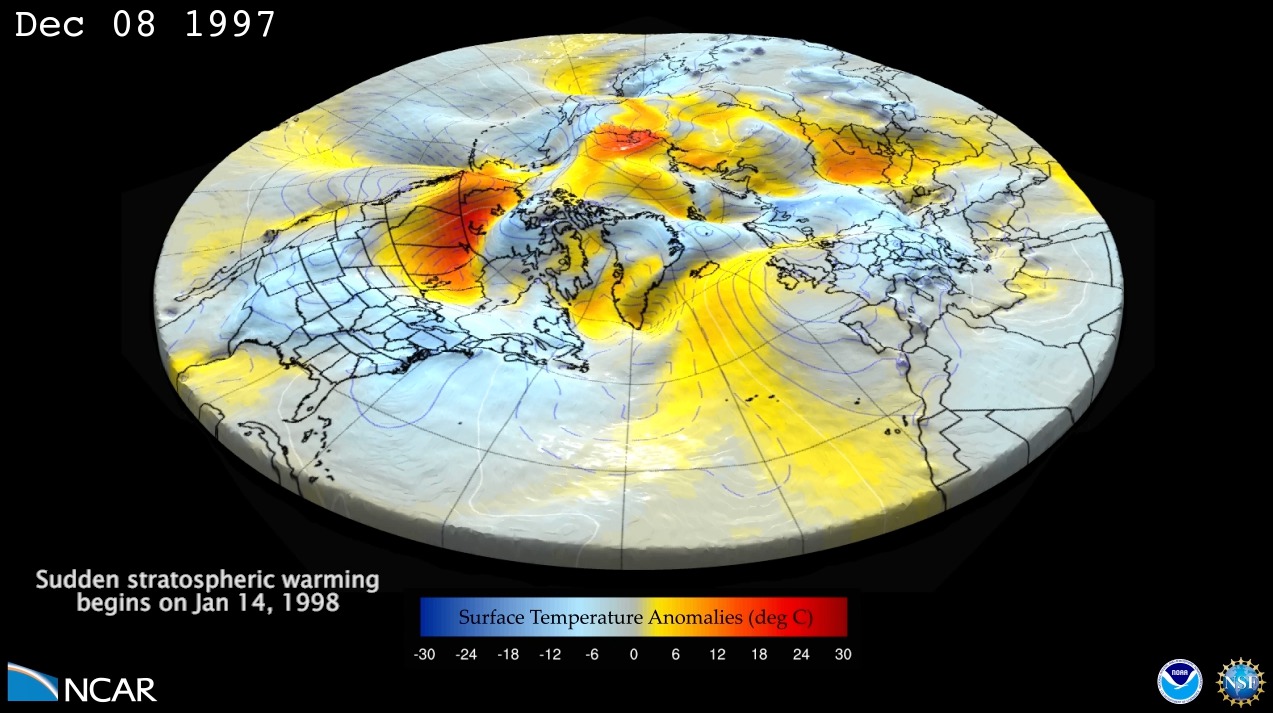
Seasonal forecast for winter of 1997/1998 with 46LCAM (Ensemble member with a sudden stratospheric warming). This is a 4 month forecast of surface geopotential height anomalies (shown with surface relief and contour lines) and surface temperature anomalies (shown with a color gradient). The forecast starts on Dec 1, 1997, and goes through the end of…
Read moreCategory: Models
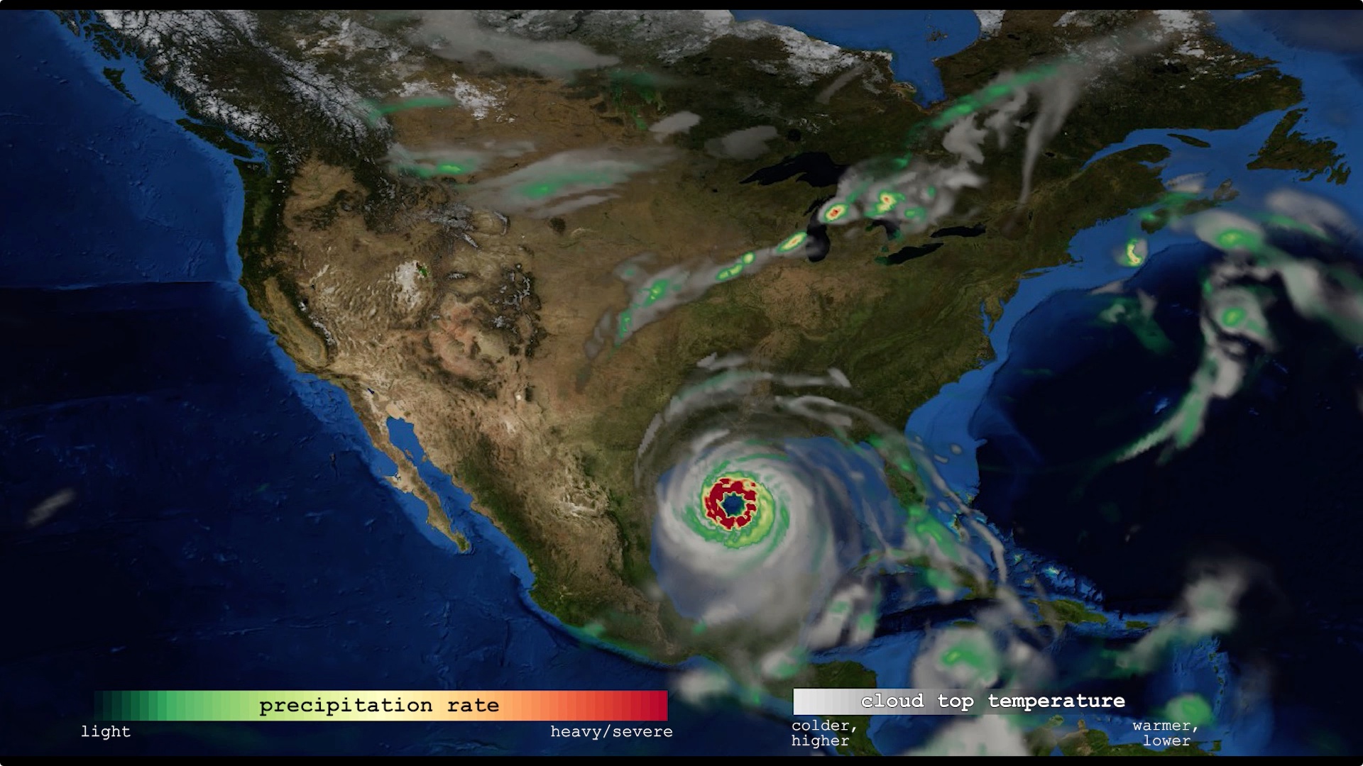
Global weather simulated by a cloud-resolving weather prediction model
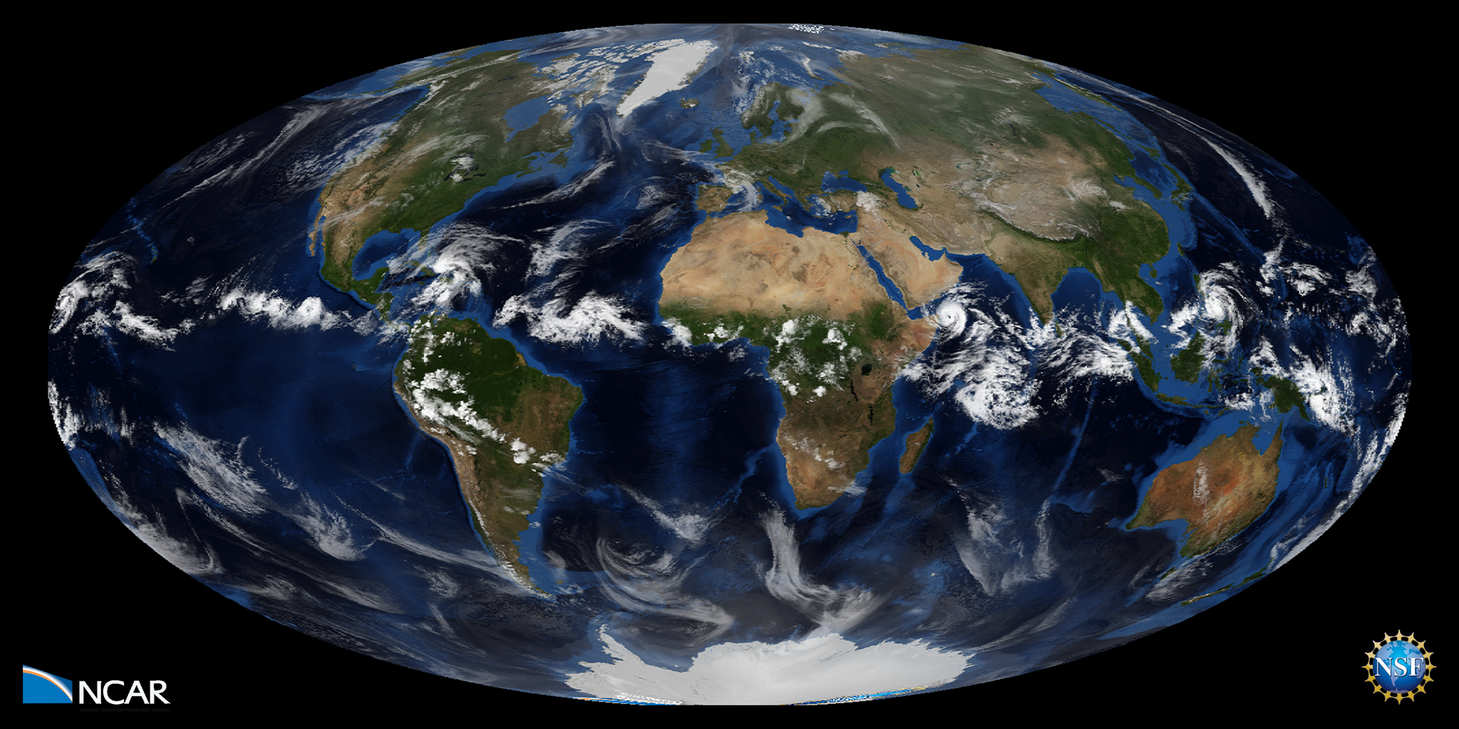
The global weather from 20 October – 4 November 2012, simulated by a cloud-resolving weather prediction model Model: MPAS – Variable: Outgoing Longwave Radiation Science: The complex evolution of multiscale cloud systems illustrates the myriad of weather phenomena that populate our atmosphere. Features of interest include the diurnal cycle of convection over central Africa and…
Read moreOcean impact on atmospheric oxygen and carbon dioxide
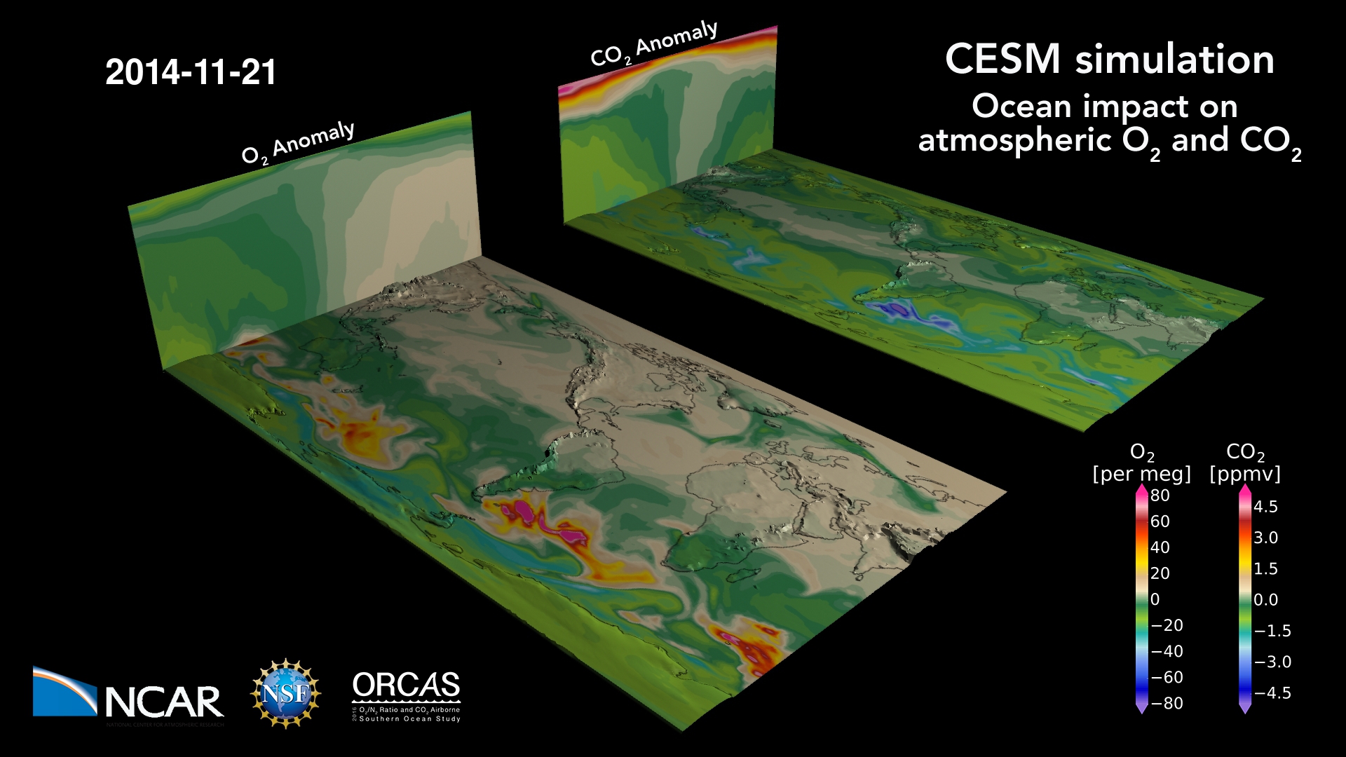
The ocean breathes: a map of oxygen and carbon dioxide variations in the atmosphere due to air-sea gas exchange, stirred by winds. The ocean absorbs CO2 and releases O2 in the summer hemisphere, primarily due to photosynthesis (and warming, for O2) at the surface; the reverse happens during winter when the surface cools and deep…
Read moreSurface Ozone Concentrations on the Colorado Front Range
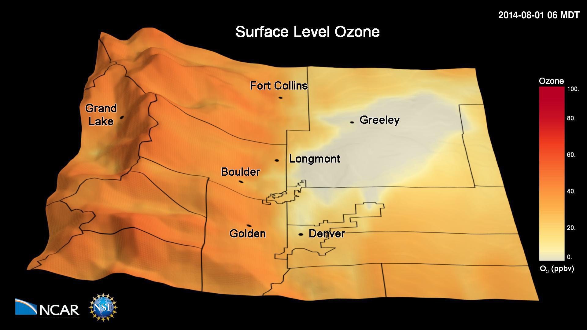
This animation shows simulated hourly surface ozone concentrations during the 2014 FRAPPÉ campaign. The simulations have been performed with the Weather Research and Forecasting (WRF) Community Multiscale Air Quality (CMAQ) model. The simulations have been conducted with a 4 km x 4 km grid horizontal resolution and show the frequent occurrence of high ozone pollution…
Read moreVariable Resolution Regional Climate Simulations with CESM
This visualization shows the output from a Variable Resolution Regional Climate Simulations with CESM (Community Earth System Model). Movies Movie File (.mp4, 319MB, 1920×1080) Images Computational Modeling Colin Zarzycki, Andrew Gettelman, Peter Lauritzen and Patrick Callaghan (NCAR/CGD) Visualization and Post-production John Clyne and Matt Rehme (NCAR/CISL) Model Variable Resolution Regional Climate Simulations with CESM (Community…
Read moreSurface Temperatures from Climate Change vs. Geoengineering
This visualization describes temperature changes relative to years 2015-2024 from unabated climate change (RCP8.5) and stratospheric sulfate aerosol geoengineering (using feedback) simulated by a state-of-the-art coupled earth system model. Geoengineering, often using stratospheric sulfate aerosols, is discussed as a potential means of deliberately offsetting some of the effects of climate change, such as rising temperatures.…
Read moreModelling The Indonesian Throughflow
Rising ocean temperatures have given rise to coral bleaching events at higher rates than have been seen in observed history. Researchers at the National Center for Atmospheric Research are studying how effectively coral reef ecosystems can repopulate each other after bleaching events through a metric called Potential Connectivity. In this visualization, we observe a state…
Read moreWind Speed
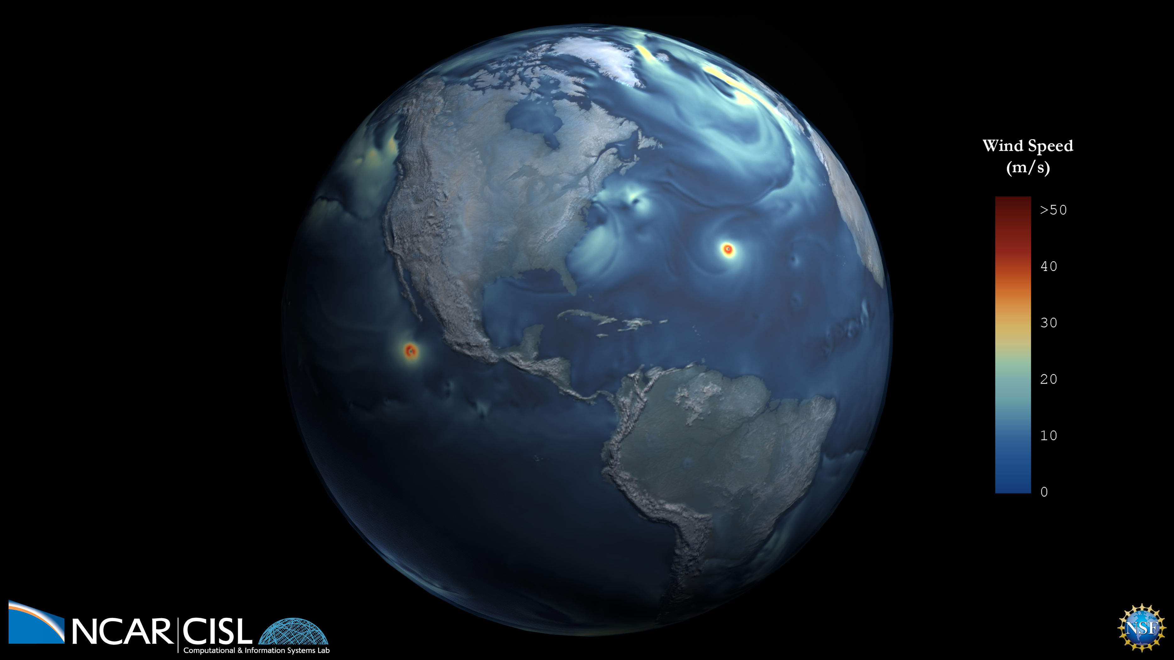
This visualization shows the magnitude of the wind speed over the course of one year from atmosphere-only simulations of the high resolution (horizontal 1/4 degree) Community Earth System Model simulating the present day climate. Movies Movie File (.mp4, 1920×1080, 588MB) Images Science Credits Susan Bates and Nan Rosenbloom Computational Resources This research used resources…
Read morePlanetary Water Vapor
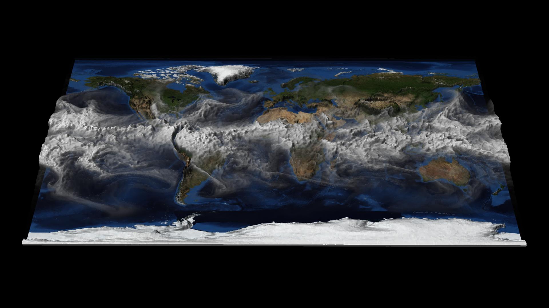
This visualization shows hourly time steps of CESM1 total column integrated water vapor (TMQ) for one year. The value of TMQ at each point determines the amount of 3D surface displacement. Higher values of TMQ have a larger displacement, helping to visually identify regions with the most significant temporal changes in water vapor. Movies Quicktime…
Read moreCESM Decadal Prediction Large Ensemble
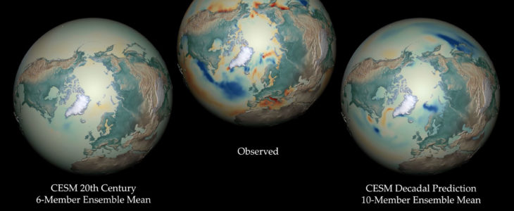
Forecasting decadal trends in the North Atlantic and Arctic Decadal climate predictions exhibit skill in retrospective predictions of observed multi-year trends in sea surface temperature (SST) and sea ice fraction in the high latitudes of the Northern Hemisphere, particularly in the Atlantic sector. The skill is largely attributable to realistic ocean initialization, but external radiative…
Read more