
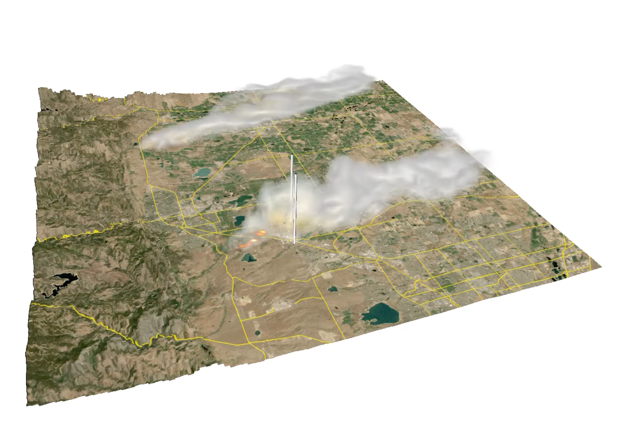
On October 14, 2020, the East Troublesome Wildfire ignited. It burnt 193,812 acres over the course of 48 days. Between October 20-23 the wildfire rapidly intensified, exploding from 18,550 acres to 187,964 acres in size.* These visualizations show a Weather Research & Forecasting (WRF) simulation of the East Troublesome Wildfire from the perspective of Granby,…
Read moreCategory: Fire Dynamics
Simulations with MUSICA (Multi-Scale Infrastructure for Chemistry Modeling)
These visualizations depict simulations created with MUSICA (Multi-Scale Infrastructure for Chemistry Modeling). The first simulation examines the Carbon Monoxide (CO) generated by a fire plume during the major fire events that occurred in the western United States in 2022. The second simulation depicts Ozone (O3) in the troposphere over a region of the western US…
Read moreSimulation of Marshall Wildfire
On December 30, 2021 the Marshall wildfire grew to be the costliest wildfire in Colorado’s recorded history. This simulation shows the spread of the fire through the towns of Superior and Louisville, CO, and some of the dynamic winds that caused this devastating event. Movies Science Credits Janice Coen (MMM) Computational Modeling Janice Coen (MMM)…
Read moreHRRR Smoke in the Summer of 2020
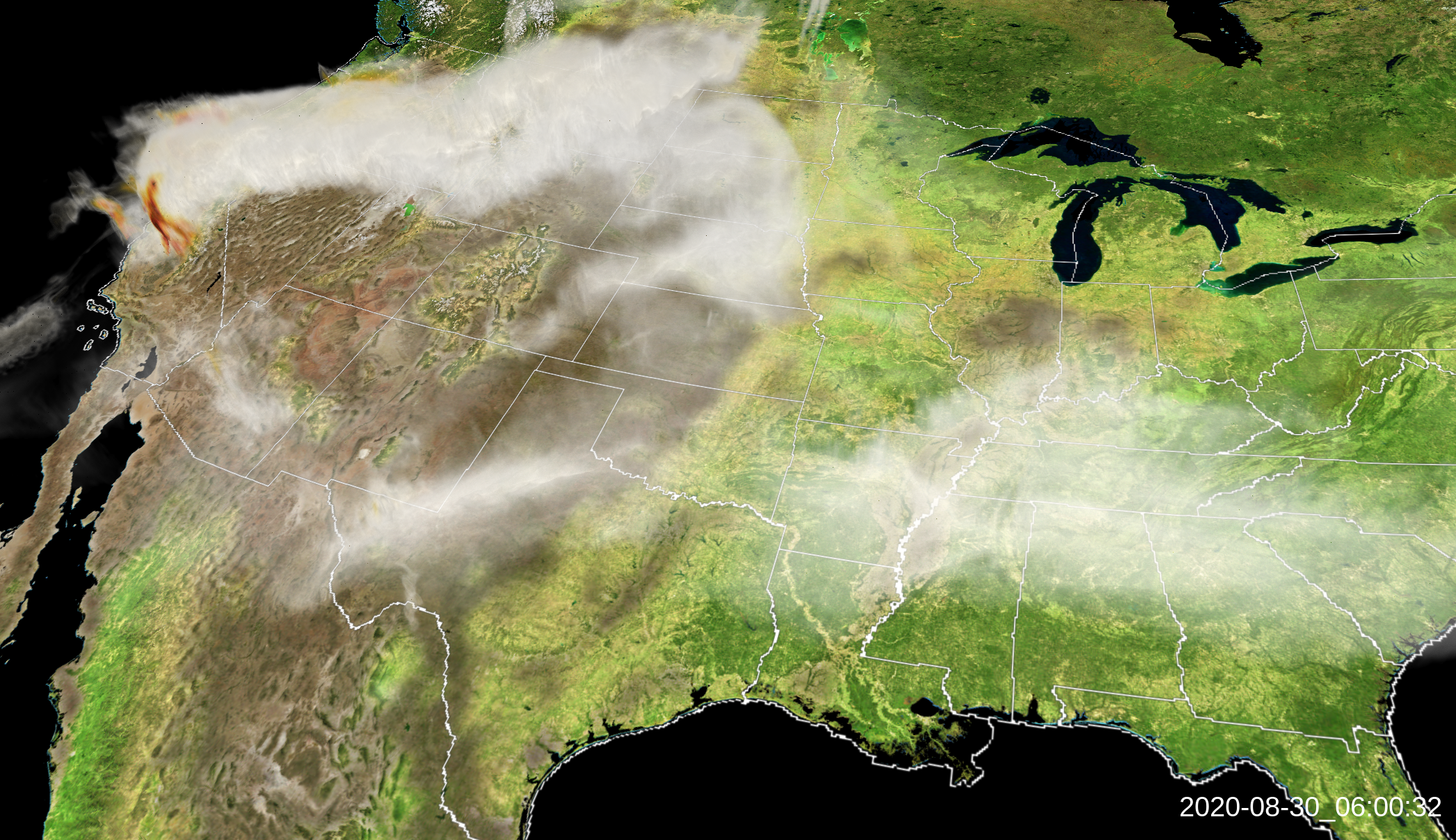
These volume renderings show the simulated dispersal of smoke generated with the High Resolution Rapid Refresh (HRRR) model. This visualization emphasizes the Western wildfires during the last days of August, 2020. Science credit to Ka Yee Wong and Ravan Ahmadov, of NOAA’s Global Systems Laboratory. Movies Movie File (430 KB, MP4) Images Science…
Read moreYarnell Hill Fire
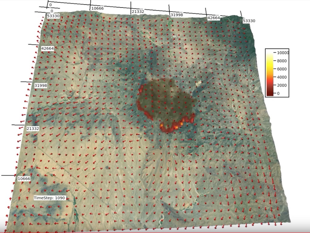
Ignition: 6/28/13 near Yarnell, Arizona Movies Images Science Credits Principle Investigator: Janice Cohen (NCAR) Collaborator: Wilfrid Schroeder (Univ. of Maryland) Visualization Software VAPOR
Read moreKing Fire 2014
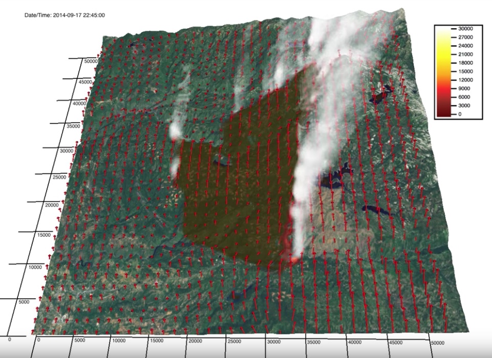
The King Fire was ignited on 9/13/14 in the Eldorado National Forest northeast of Pollock Pines, CA, where pine plantations lie between steep canyons. Eventhough fuel conditions were dry, environmental winds recorded at nearby weather stations were weak, thus rapid fire growth was not expected. On the 17th, the north-spreading fire reached the Rubicon canyon…
Read more