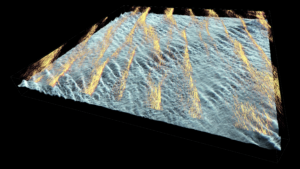
As the hurricane approaches and the wind intensifies, the ocean surface current (orange) organizes into streaks along the wind direction. About 10 m below the surface, intermittent billows perturb the temperature interface (blue-gray) and drive exchange between the warm surface and cold bottom waters on the Mid-Atlantic Bight.

